New renderings stitch together all of the plans for the river and its banks
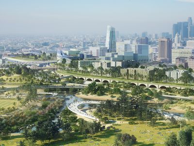
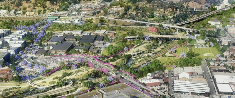
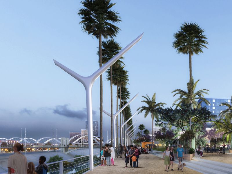
Splashy new renderings show what a greened-up LA River—surrounded by parks, jacaranda trees, restored marshlands, and new high-rises and mixed-use development—might look like decades from now.
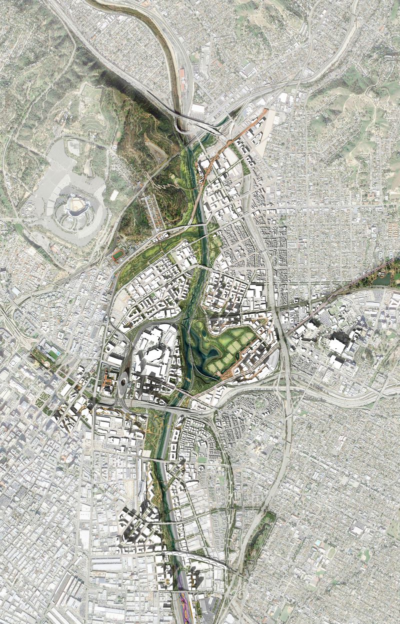
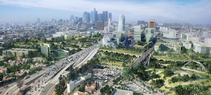
The renderings were released this week by AECOM, a giant Los Angeles based engineering, engineering, design, and consulting firm, and they zero in a four-mile stretch of the river from about the southern edge of the Arts District to just north of Dodger Stadium.
Returning the concrete channel to a more natural state, a waterway that residents can interact with, is one of the most exciting and most anticipated urban design projects on the horizon for Los Angeles.
There is already a bounty of ideas and proposals for what that might look like. AECOM isn’t proposing anything new.
Rather it has knitted together dozens of community and master plans—including the Boyle Heights Community Plan, Cornfield Arroyo Specific Plan, Civic Center Master Plan, and Union Station Master Plan—and development plans that have already been approved. (By AECOM’s estimate, there is 8 million square feet of entitled development in the area). It also incorporates plans for Taylor Yard, a former freight-switching facility that’s poised for a Mia Lehrer-led revamp.
“All we’re doing is showing how the pieces fit together,” says Nancy Michali, AECOM’s vice president of urban design. “We are building on what others have already done.”
If all the plans are eventually brought to fruition, the firm estimates there will be 300 acres of new parks, 7.2 miles of new bike paths, and a 50 percent increase in tree canopy.
The illustrations are packaged with recommendations for how public agencies, such as the city, county, and Metro, could partner with nonprofits and businesses to raise money to implement the changes. Together, AECOM is calling its work the “LA River Gateway Plan.”
It was developed with input from Los Angeles Mayor Eric Garcetti. His spokesperson, Alex Comisar, says the gateway plan helps “bring decades of planning and design work to life … and shows Angelenos what the river’s future could be.”
Marissa Christiansen, executive director of the nonprofit Friends of the Los Angeles River, says AECOM has “layered all of the existing plans that so many community members, designers, engineers and architects have worked on over the years to visually show what it would look like if they were fully implemented.”
On whether the plan will actually be put to use, Christiansen says, “I don’t know. There are a lot of plans out there that end up getting a lot of excitement and have a hard time getting implemented.”
AECOM says it wants to be “thought leader” for the river’s revitalization. It’s not the only one.
The biggest name is Frank Gehry. The starchitect is working on his own master plan for the river. It hasn’t been released yet to the public, and Mitcheli says Gehry’s firm declined to work with AECOM on its gateway plan.
She says she’s felt like a matchmaker while developing the plan over the past year, introducing officials and staffers from the county, city, and Metro who should have been talking to each other about what they’re up to—but haven’t been.
“We want them to stop and think about how the pieces could fit together, and not do it piecemeal,” she says.